Mavrx app Review

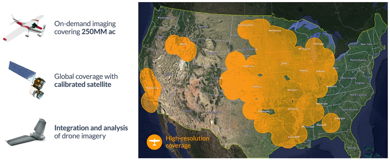
Mavrx bills itself as the “‘Uber’ of agricultural imaging”, which is a great way to describe what they do. By contracting with airplane pilots throughout the country, they provide retailers and growers with ultra high-resolution photos of fields within 24 to 72 hours. These photos show a lot more detail than satellite imagery, so I think Mavrx steps it up when comparing their field analysis accuracy against the offerings of similar apps.
My favorite part of using the Mavrx app is that it’s been an incredible time saver when it comes to scouting fields. Scouting is traditionally a very labor-intensive task, but Mavrx has streamlined the process by giving agronomists and growers an initial field analysis before they even step foot into a field.
The scouting feature of the app uses ultra high-resolution imagery and algorithms to identify a field’s potential problem areas and suggest a more efficient route when scouting. This means less time spent wandering a field when looking for trouble spots. You can also upload the notes and photos you take in the field, geo-tag the information and instantly share it with clients.
The app also has field analysis capabilities that assist with in-season nitrogen (N) management, relative crop growth assessment, yield predictions and field profitability mapping.
Another of Mavrx’s noteworthy strengths is that its interface works really well. We all know how frustrating it can be when an app freezes up, but in my experiences it has been completely flawless. And it’s compatible with Apple, Android and Windows operating systems, so it can be used across a number of platforms.
THE BOTTOM LINE
Mavrx’s use of ultra high-resolution photos provides customers with more comprehensive information than some of the other similar apps that are out there. It is a great collaboration tool for retailers and farmers and it’s fast, intuitive and simple to navigate.


